Local Plan (2018-2031) Special - Final Draft
The Borough Council's final draft Local Plan has now been published for consultation. Catchily entitled 'Regulation 19 Pre-Submission September 2018', it can be viewed during office hours at the Borough's Kings Hill Office at Gibson Drive; local libraries including Martin Square; and at the Parish Council Office at Church Farm, New Hythe Lane. It can also be viewed online by visiting:
Anyone can send representations, including landowners and developers - but all comments must be received by 4pm on 19th November. The East Malling Conservation Group has produced a petition which is available on their website at www.emcg.org.uk. You can either sign up to support the whole document or use it to help you write the content of your own letters.
The Borough will send all comments to the Planning Inspectorate ahead of the 23rd January 2019 deadline. Should it fail to do so it will be required by Government to find land for 23% more homes on top of the c7000 homes in this Plan.
As Trudy Dean says, the plan is a 'mixture of good and bad news'. So, here are the main details...
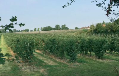
EAST MALLING RESEARCH LAND
Earlier drafts of the plan proposed a large area of land either side of Hermitage Lane for housing but there was concern about the highway impact. As a result, while the area known as 'White Post Field' on the southeastern corner of the A20 and Hermitage Lane (with a proposed road through it to the Poppyfields roundabout) has been kept, the rest has been deleted. Instead, the plan now includes land at 'Ditton Edge' at the rear of Cherry Orchard, Kiln Barn Lane, Ditton and at 'Parkside' next to New Road, East Malling. This is an example of the system whereby, if one site is removed, another has to be included to meet the housing numbers set by Government.
KINGS HILL EXPANSION NORTHWARDS
The expansion of Kings Hill down to Pikey Lane has been kept in the plan, with a possible link road out to the A228 opposite West Malling station. The wording of this policy is now better and, except for emergency access, restricts access from the development onto the network of 'quiet lanes' such as Well Street and Broadwater Road. Originally the whole of Broadwater Farm was put forward but the Green Belt extension, if approved, would rule that out.
GREEN BELT EXTENSION KEPT IN THE PLAN
It is good news that the Green Belt extension covering land between East Malling and West Malling down to the A20, including 40 Acres, has been carried through to the final plan and is now a firm policy to be considered by the Planning Inspectorate. If approved it would rule out the application by Wates to build on 40 Acres and other sites proposed in the past. We will argue that the the extension protects the setting of historic West Malling and prevents Kings Hill, West Malling and East Malling merging into a conurbation with Larkfield and Leybourne. Lots of you wrote in to support this policy which we would ask you to do again so the Planning Inspectorate understands the strength of feeling.